Moving and a New Job!

I would like to officially announce, that as of yesterday, I have officially started my new job as a Research Scientist – Earthquake Seismologist with Natural Resources Canada, working for the Pacific Division of the Geological Survey of Canada in Sidney BC.

I’m looking forward to many years ahead of interesting new research projects and new colleagues!

Two new papers published!

Two new papers out and available in the last month:

New paper in Geophysical Journal International by Milne et. al. examining effects of lateral Earth structure (seismic velocities translated into mantle viscosity variations) on the predicted glacial isostatic adjustment of Greenland. Find the article online at Geophysical Journal International or a direct link to the PDF.

New paper in Journal of Geophysical Research by Golos et. al. presenting a new shear velocity model of the continental United States computed using a joint inversion of body wave and surface wave data dominantly recorded using the USArray, but including numerous other national, permanent, and temporary networks. Find the article online at Journal of Geophysical Research or a direct link to the PDF.

New Papers Published!!

Two new papers out in recent months:

New paper in Science Advances by Audet and Schaeffer examining the nature of the along-dip transition from seismogenic zone to stable sliding region in the Cascadia Subduction zone combining offshore Cascadia Initiative OBS with onshore CAFE stations. Find the article online at Science Advances or a direct link to the PDF.

New paper in Tectonophysics presenting the M.Sc. Thesis work of UOttawa student Morgan McLellan  exploring the structure and dynamics of the Northern Canadian Cordillera using surface wave phase-velocity measurements.  Find the article online at Tectonophysics or a direct link to the PDF.

BISN: One Year Later in the Canadian Arctic

This past July, we revisited the BISN (Banks Island Seismic Network) Sites that were installed the previous summer. Despite some weather related logistics, we were able to successfully visit each of the three seismometers.

As is common working in these challenging conditions, we were met with mixed results in terms of the sites themselves. Prior to travelling North, we already new that the site at Nelson Head had been wrecked over winter. Even after visiting the site, we are unsure weather this was due simply to high winds or if any Polar Bears had any impact. Thankfully, the remaining two sites, Bar Harbour and Johnson Point were both upright.
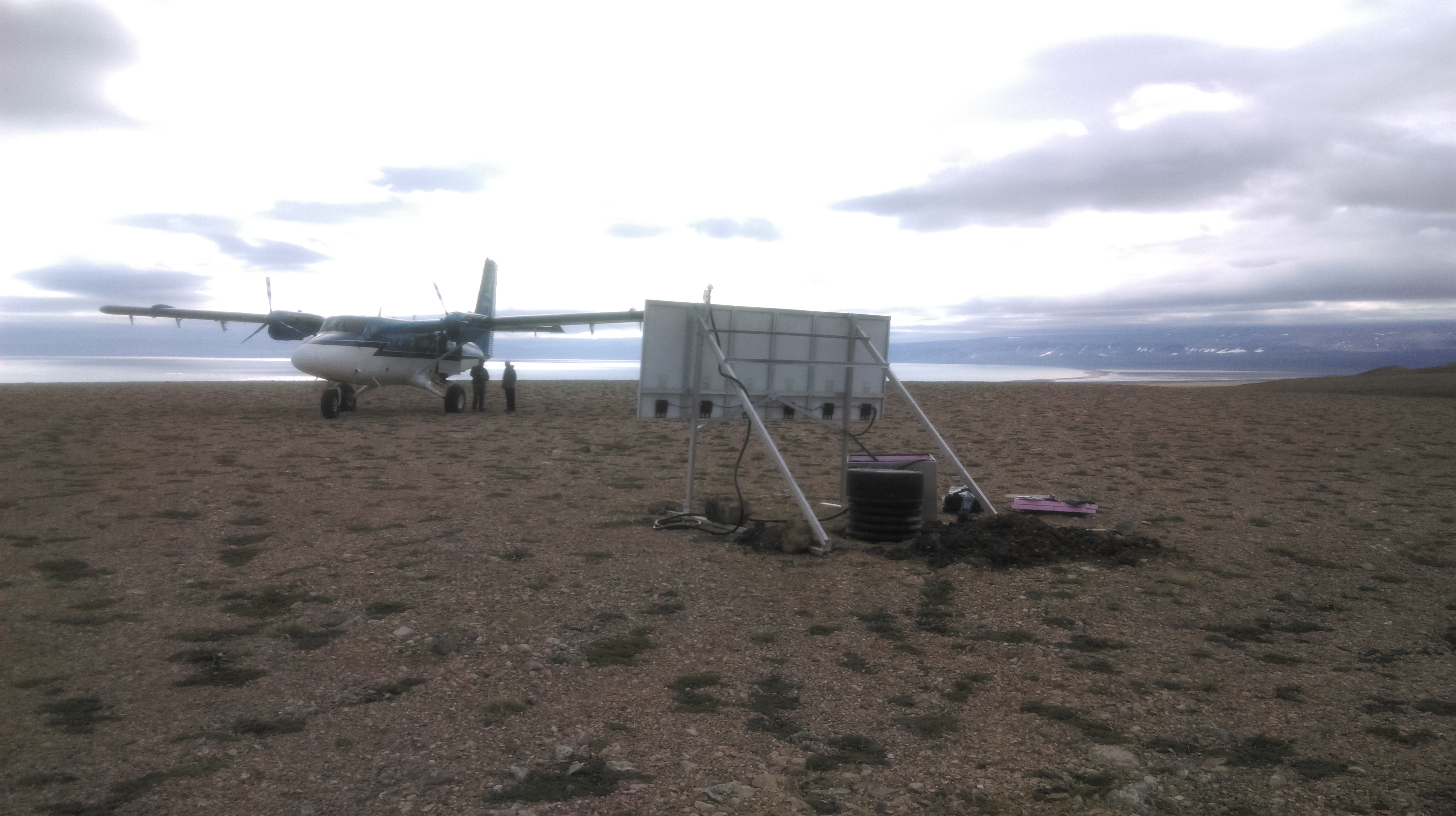


Bar Harbour:
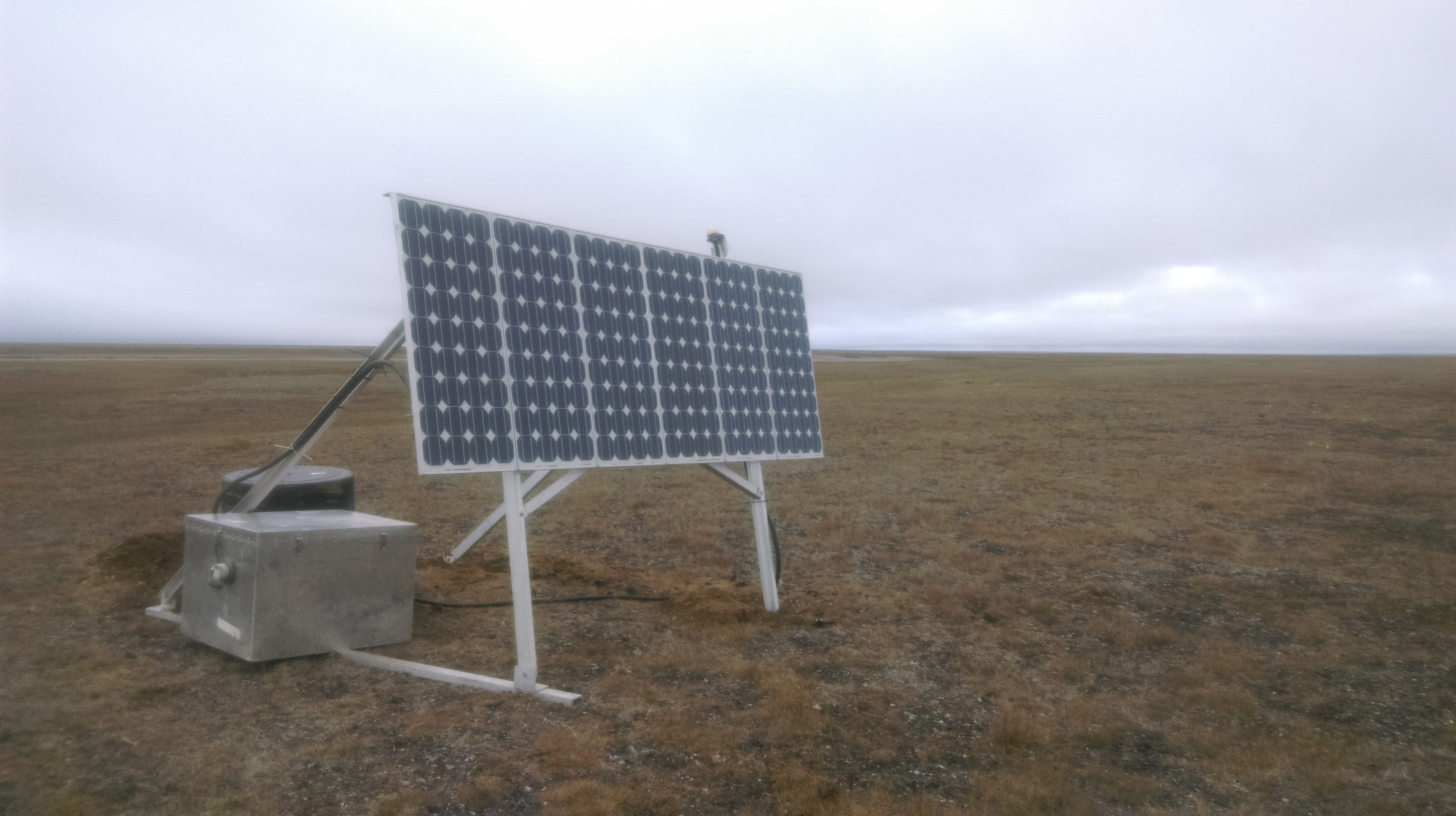
The most northern and remote of the three sites, this one is more challenging to access due to the tight landing requirements. The “runway” is a sandbar in the bend of the river, and due to its orientation, means a successful landing can only be made when the wind is blowing in the east-west direction. Furthermore, we actually need this east-west wind to land and take off from due to how short the runway is. Although the site was still standing, it was not running. It appears that after it shut down in late-December, the solar controller was fried, possibly due to a lightning strike over an overload during charging. Unfortunate, but you live and learn. Thankfully there is some good data collected from the site prior to its shutdown.
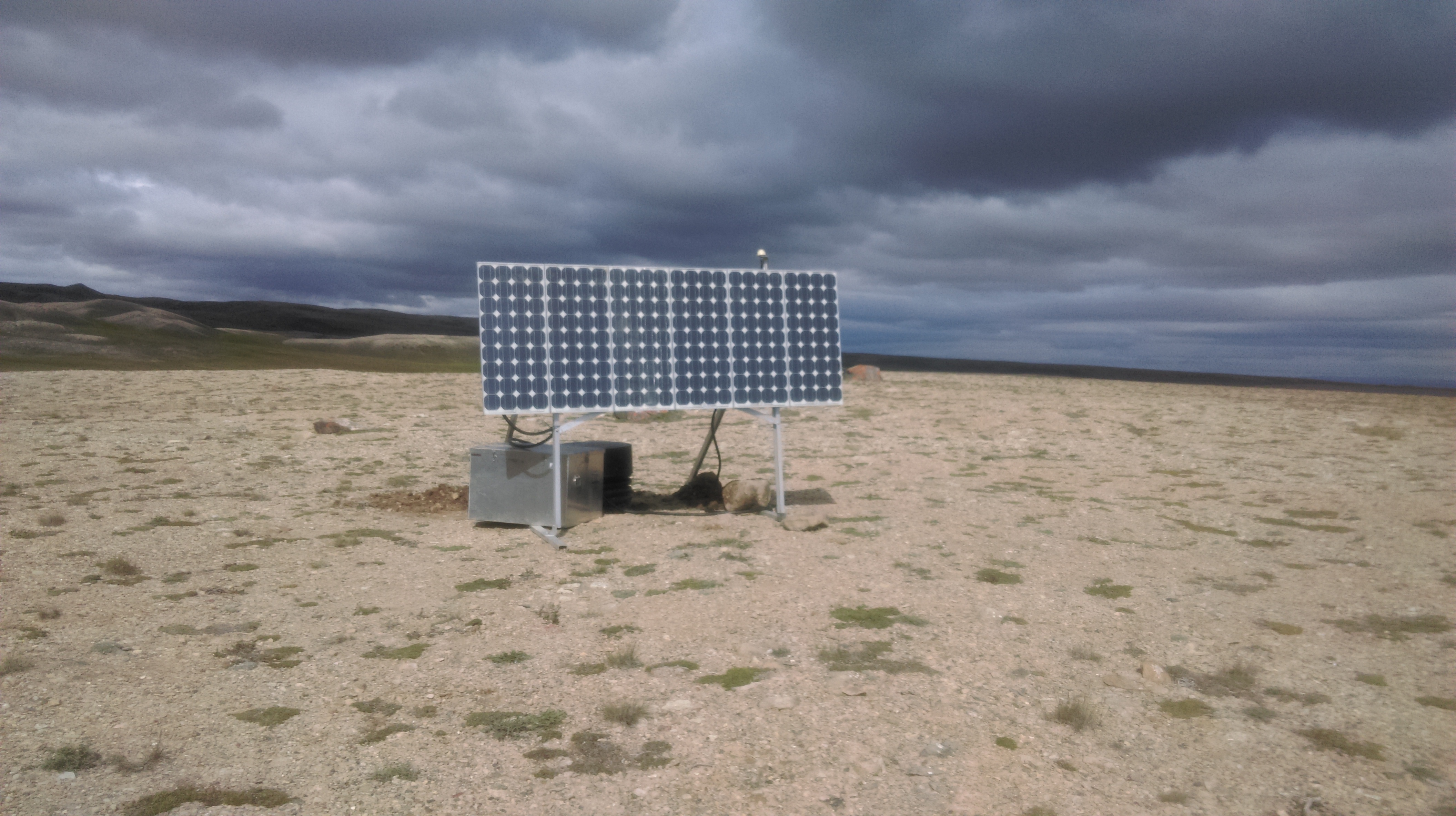
2016-07-07 13.15.252015-07-23 16.53.45


Johnson Point:
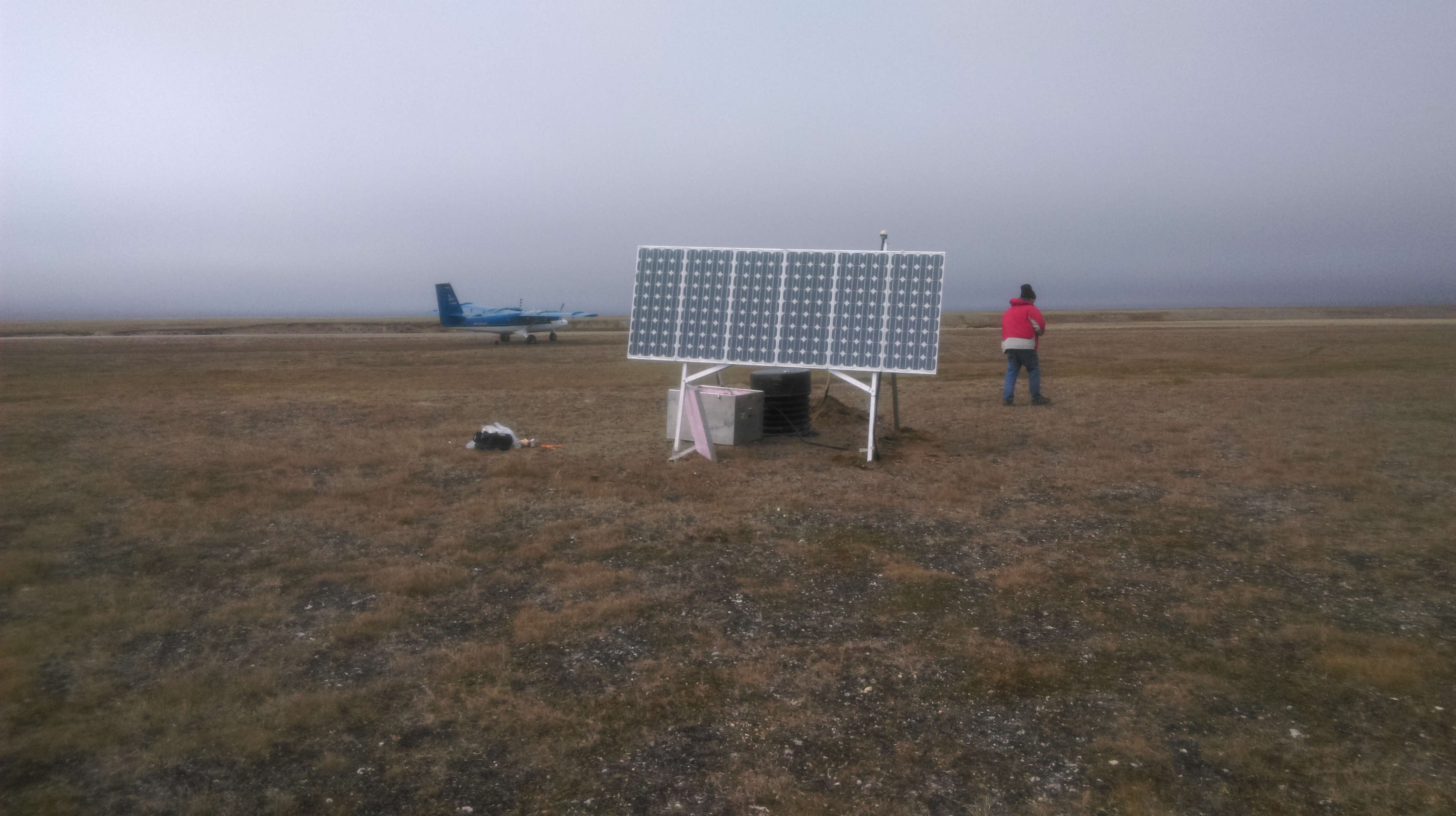
This site was running upon our arrival! Hurray! It did shutdown for some time over the middle of winter. There is no light, so the batteries are completely drained. This year, it woke up again. As we visited earlier than last there, there was an incredible ice-wall built up along the beach resulting from wind and wave action stacking the incoming sea ice on the beach. This made the site visit a bit more nerve wracking as this wall only 15m away posed as an ideal spot for Polar Bears to sneak up on us.
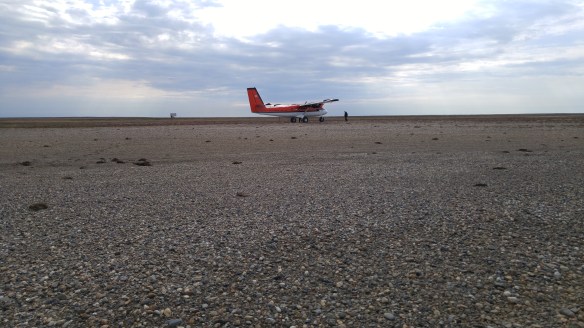
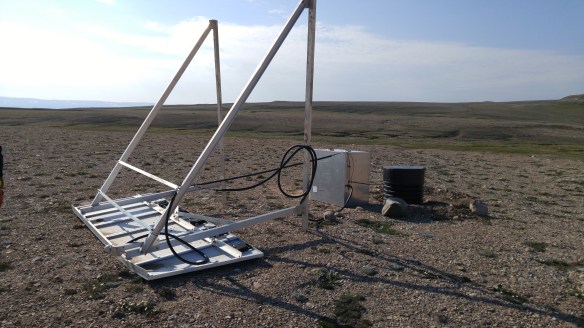
2016-07-07 16.15.14


Nelson Head:
This site had been knocked over, either by the winds or a helping paw from a passing Polar Bear. Either way, it recorded data through to late November, which was a great relief. The hardest part about installing these sites in this remote location was flying away on the plane hoping that everything was set up correctly and the data was being recorded.
2016-07-07 18.01.24


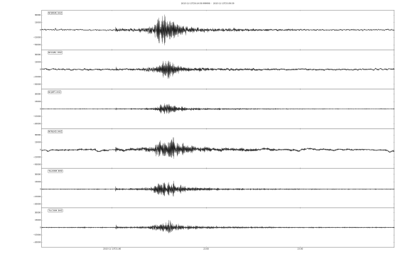
Below is a sample figure showing the same Earthquake recorded at the three BISN stations (BRHR, NLHD, JNPT), one at the Norman Wells Array (CARC), and two USArray Tranportable Array Stations (A36M in Sachs Harbour and C36M in Paulatuk). The earthquake was a magnitude 6.7 in Ryuku on November 13th 2015.

2015-11-13_M6p7_Ryuku

The Beginnings of BISN (the Banks Island Seismic Network)

This summer we installed 2 new seismic stations on Banks Island, complementing the USArray Transportable Array station (A36M) located in Sach’s Harbour, southwest Banks Island, and a temporary site located at Johnson Point, eastern Banks Island. The project is a collaboration between the University of Ottawa (uO) and the Northwest Territories Geological Survey (NWTGS), with funding from the Polar Continental Shelf Program (PCSP), the NWTGS, and uO.

The two new stations are BRHR (Bar Harbour) and NLHD (Nelson Head), located at the northwest and southeast corners of the island, respectively. Their remote locations were accessed using a Twin Otter on Tundra tires, making for some fairly exciting landings at times.

Bar Harbour:  ~74°N 124°W
2015-07-23 16.46.00 2015-07-23 16.53.45

Nelson Head:  ~71°N 122°W

2015-07-22 15.26.01 2015-07-22 15.58.03

Although two additional sites were planned for installation, inclement weather conditions prevent all the gear from being delivered to Johnson Point. Ideally next year during the service run, the additional stations will be installed in northeast Banks Island and northwest Victoria Island. Stay tuned…